Urban canoeing: Cedar Lake to Minnehaha Falls and back

IMG_5887_sm.gif

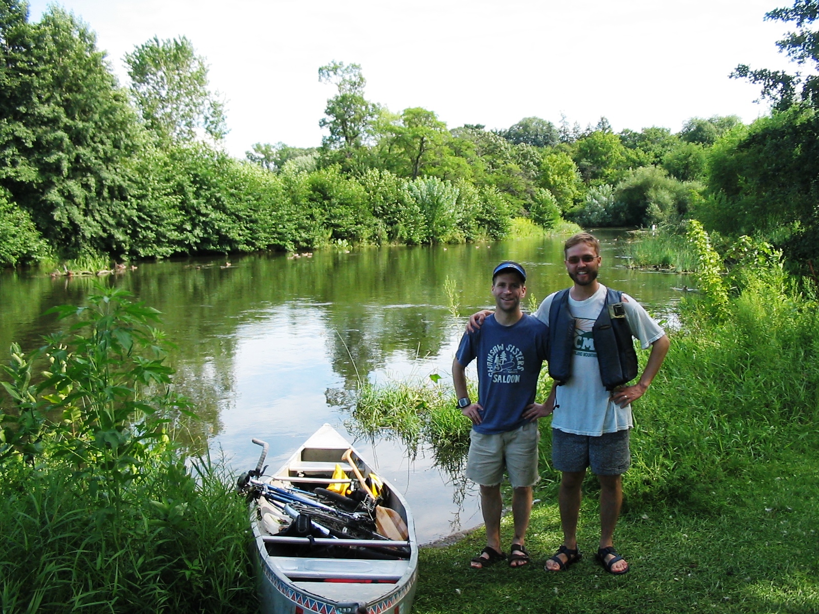
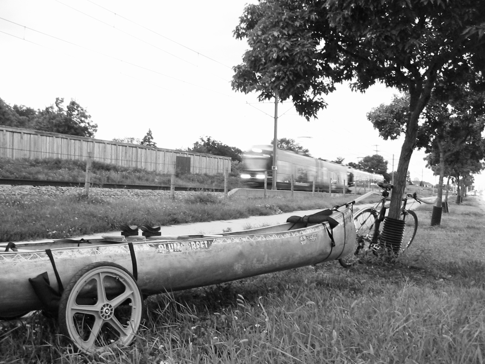
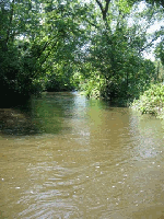
Chris Desjardins and I took another urban canoe trip yesterday. We originally planned to pick up where we left off last time, at Hidden Falls in Saint Paul, but we chose a different route to take advantage of recent rains that had swollen Minnehaha Creek and to try out my Wike Woody Wagon Canoe Trailer.

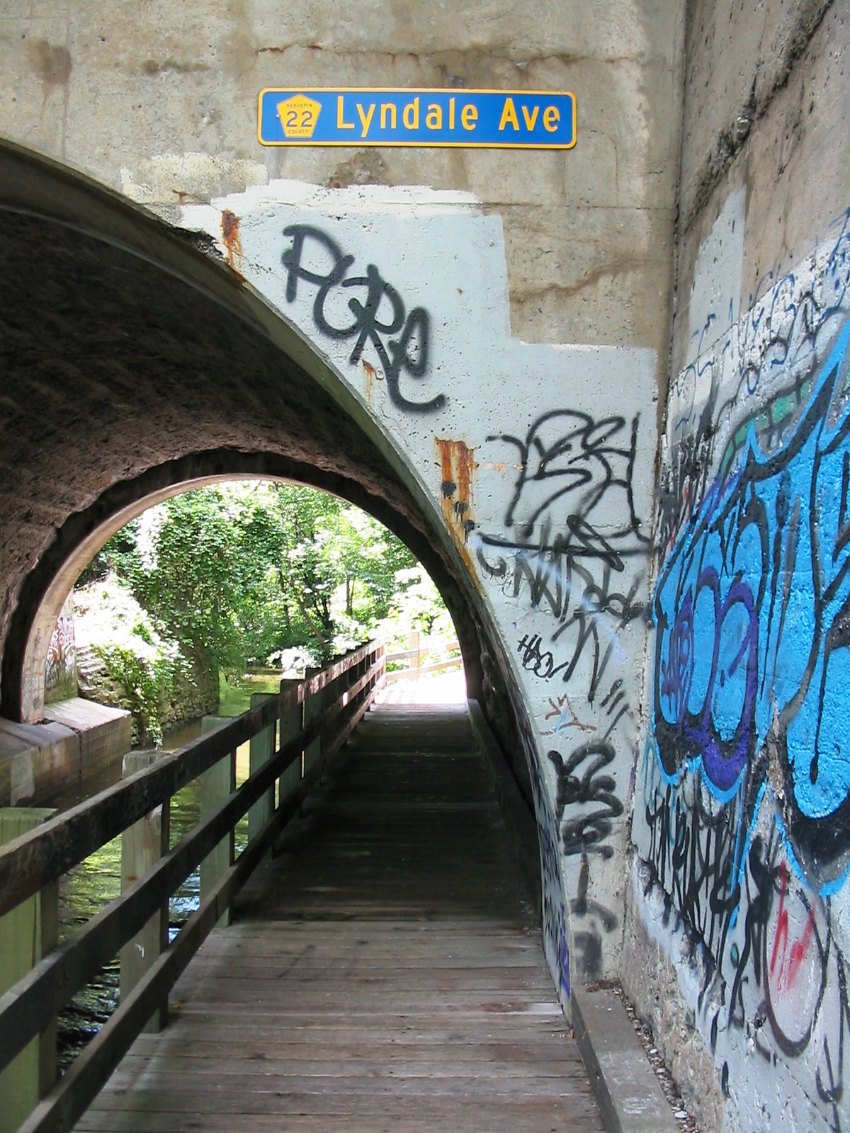
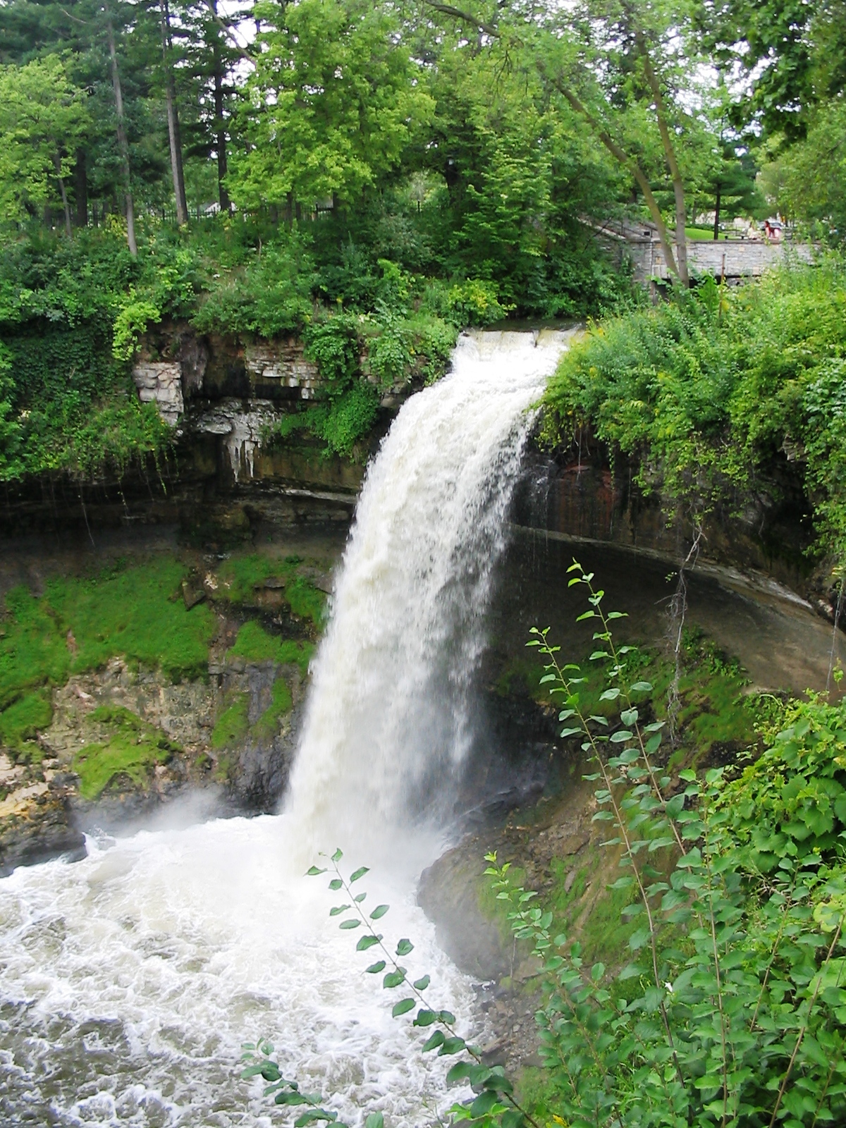
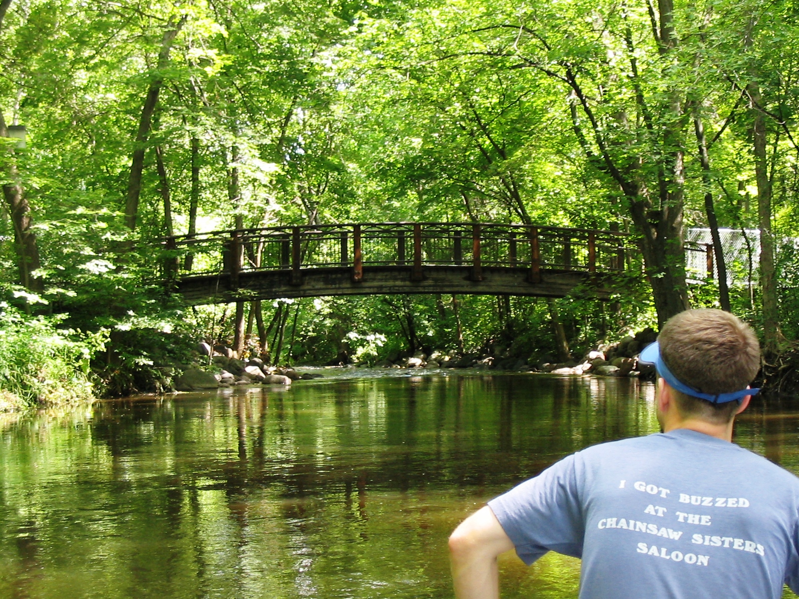
We left from Cedar Lake where my canoe, Scrappy, resides on a rack rented from the City of Minneapolis. After loading my bike, we paddled through Lake of the Isles to Lake Calhoun, portaged to Lake Harriet, and then portaged over to Minnehaha Creek. The creek was so high that we had to portage around or duck under several bridges. We used the bike trailer for the longer portages before the creek, and after reaching Minnehaha Falls, I transported Scrappy all the way back to Cedar Lake by bike. Click here for a map of our canoe route.

The entire trip took about seven hours, not counting a stop for dinner at Sea Salt Eatery. My bike took a beating from trees and a wall along the creek, the Wike trailer didn’t perform as well as I had hoped, and I’m still exhausted the next day, but I thoroughly enjoyed the Cedar-Minnehaha-Cedar loop. I especially got a kick out of people’s reactions to Scrappy hitched to my bike.

IMG_4091.jpg IMG_4097.jpg IMG_4109.jpg
IMG_4094.jpg IMG_4104.jpg
IMG_4106.jpg IMG_4114.jpg

Posted in Personal | Comments Off on Urban canoeing: Cedar Lake to Minnehaha Falls and back

Structural equation modeling for theory-driven evaluation

Just to show that I’m not the biggest slacker-blogger on the Web, I want to direct you to my guest-post on AEA365: A tip-a-day by and for evaluators. I chose my “tip” because I think structural equation modeling (SEM) and logic modeling would complement each other very well, but very few researchers have combined the two approaches. Those of us who use SEM know how important it is to have strong prior theory for model fit and valid conclusions. We could learn a lot from evaluators who are skilled at developing logic models. Conversely, theory-driven evaluators could improve their practice by carefully attending to statistical power, construct validity, attenuation due to measurement error, and the decomposition of total effects. I am very interested in hearing others’ opinions on this issue, so please leave a comment here or at AEA365.

A logic model (left) operationalized as a partial mediation growth model (right)
AEA_Tip-a-Day_Logic_Model.png AEA_Tip-a-Day_Path_Diagram.png

Posted in Praxes | Comments Off on Structural equation modeling for theory-driven evaluation

Regression discontinuity gallery: Spatiotemporal piecewise regression

I think I have settled on a dissertation topic: spatiotemporal piecewise regression evaluation. Spatiotemporal piecewise regression (SPR) refers to the analysis of longitudinal data from a spatial regression discontinuity (SRD) design with multiple pre-test observations. SRD offers a way to quasi-experimentally estimate local average treatment effects (LATEs) of geographically implemented programs or policies; SPR is a way to estimate change in LATEs over time. My dissertation will describe SPR methodology in detail, including validity threats, and demonstrate an SPR evaluation of an educational program. As discussed by Shadish, Cook, and Campbell, multiple pre-test observations will allow me to address validity questions.

I decided to conduct a preliminary SPR analysis of data from the educational program to determine if the topic would be feasible and to include some results in a conference paper proposal. As discussed in earlier posts (here, here, and here), Rlogo.jpg can be used to plot regression discontinuity fitted lines, showing the LATE at the treatment assignment cutoff point. The ggplot2 package can be used to plot SPR fitted lines and change in LATEs over time, but it’s not easy. One reason is that ggplot2 has a steep learning curve and limits control over the legend’s appearance, although its curve is not as steep as lattice’s. Another reason SPR plots are difficult to produce is that they represent several dimensions: north/south/east/west (reduced to one-dimensional distance), time, and the outcome. The SPR plots below show that participation in the educational program is associated with an initially positive, small LATE that diminishes over time.

Spatiotemporal piecewise regression fitted line plots
spatiotemporal_piecewise_regression_LATEs.png spatiotemporal_piecewise_regression.png

Posted in Praxes | Comments Off on Regression discontinuity gallery: Spatiotemporal piecewise regression

Compressing KML files with R

Compressing Google Earth files with Rlogo.jpg is not well documented on the Web, so I thought I should share my approach. I am working on my presentation for the upcoming Minnesota Assessment Conference. I will be presenting geographic maps of 2010 Minnesota assessment results. To minimize clutter in the maps and enhance the experience of stakeholders, I am creating two versions of each map: a static PDF map with no school district labels and a Web-based, interactive map. Each PDF will link to a keyhole markup language (KML) file through Google Maps, much like this proficiency map described here.

The KML file sizes exceed Google Maps’ interface limit, so I had to find a way to compress them into KMZ files. I could compress each KML file using Google Earth or 7-Zip, but since I am already creating the maps with Rlogo.jpg, I decided to find a way to compress the KML files via code. Gunzipping is easy in Rlogo.jpg (e.g., see gzfile), but Google Maps will not accept gunzipped KML files. Thanks to Duncan Temple Lang, the zip() function in library(Rcompression) will create KMZ files with standard ZIP compression. Here’s a reproducible example:

library(maptools)
data(wrld_simpl)
sw <- slot(wrld_simpl[wrld_simpl$NAME=="South Africa",], "polygons")[[1]]
tf <- tempfile()
kmlPolygon(sw, kmlfile=paste(tf, ".kml", sep=""), name="South Africa", col="#df0000aa", lwd=5, border=4, kmlname="KMZ test", kmldescription="<i>KMZ</i> file created with <a href='http://www.r-project.org'>R</a>.")
install.packages("Rcompression", repos="http://www.omegahat.org/R")
library(Rcompression)
zip(zipfile=paste(tf, ".kmz", sep=""), files=paste(tf, ".kml", sep=""))
paste(tf, ".kmz", sep="") #path and filename

Posted in Praxes | Comments Off on Compressing KML files with R

Florida paddling excursions

IMG_4036.jpg

Amy and I had a wonderful time vacationing in Florida with my family. We visited Cedar Key along Florida’s hidden coast and stayed the rest of the time in Redington Beach. The BP oil spill had not yet reached the coast there, but almost every Floridian we talked to was bracing for environmental and economic disaster.

IMG_1182.jpg

We experienced the Gulf of Mexico ecosystem by boat on three different occasions. Amy and I paddled a tandem kayak from Cedar Key out to Atsena Otie Key and Snake Key, two islands within the Cedar Keys National Wildlife Refuge. We encountered great egrets, cormorants, and a pod of dolphins that swam within 10 yards of our kayak. The kayak was provided at no extra charge by Faraway Inn, a nice place to stay in Cedar Key. Vsiting the Shell Mound, built over 3,000 years by Native Americans, was another highlight from our time in Cedar Key.

IMG_3816.jpg

For our second excursion, we headed to Manatee Springs State Park where we rented a canoe to explore the springs and the Suwannee River. We were amazed by the clear blue water of the springs, the cypress trees covered with Spanish moss, the sturgeon leaping out of the river, and the amount of sunbathing turtles and alligators.

We were sad that we didn’t see any manatees at Manatee Springs or in the Suwannee River, but my family and I saw a couple manatees on the third paddling excursion at Fort De Soto Park. They were eating near Soldier’s Hole in Mullet Key Bayou, and we caught glimpses of them when they surfaced to breathe.

Posted in Personal | Comments Off on Florida paddling excursions